Today we were going to make the long passage across to Dirk Hartog Island. We got ourselves ready as quickly as we could, though not as quickly as we would have liked, we were still finding our way around all the things that had to be organised. The forecast was for an easterly which would give us an easy run, but it was also predicted to moderate over the day. However, it was certainly not lacking in strength as we zipped out through the channel with our sails reefed. “We’ll be there in no time”, we thought.
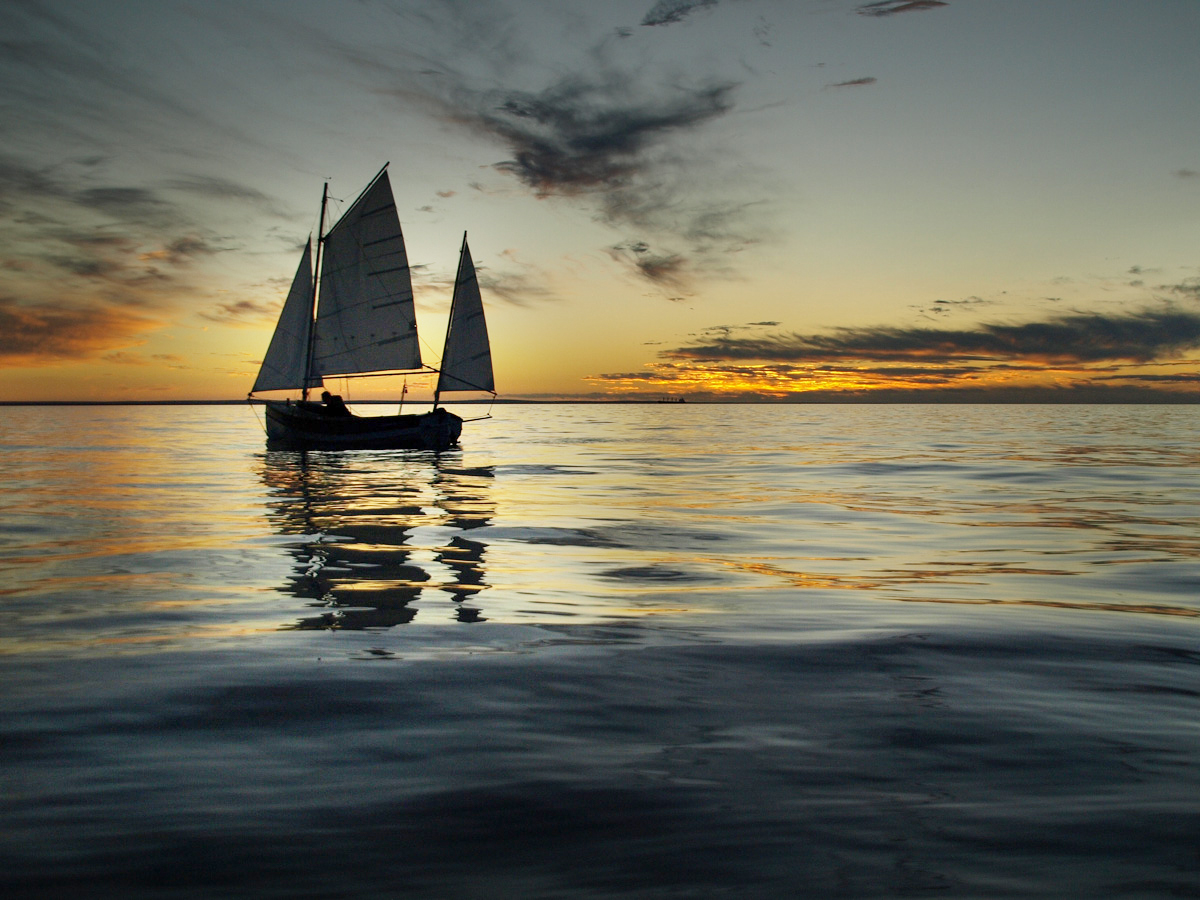
Our destination, while not totally fixed, was nominally Tetradon Loop. A large shallow bay capable of offering good protection for just about any wind direction. We were going to need somewhere to hole up for a couple of days while the northwesterly storm passed through. It was exciting to head out with our destination out of sight beyond a clear horizon.
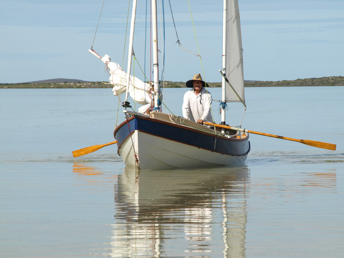
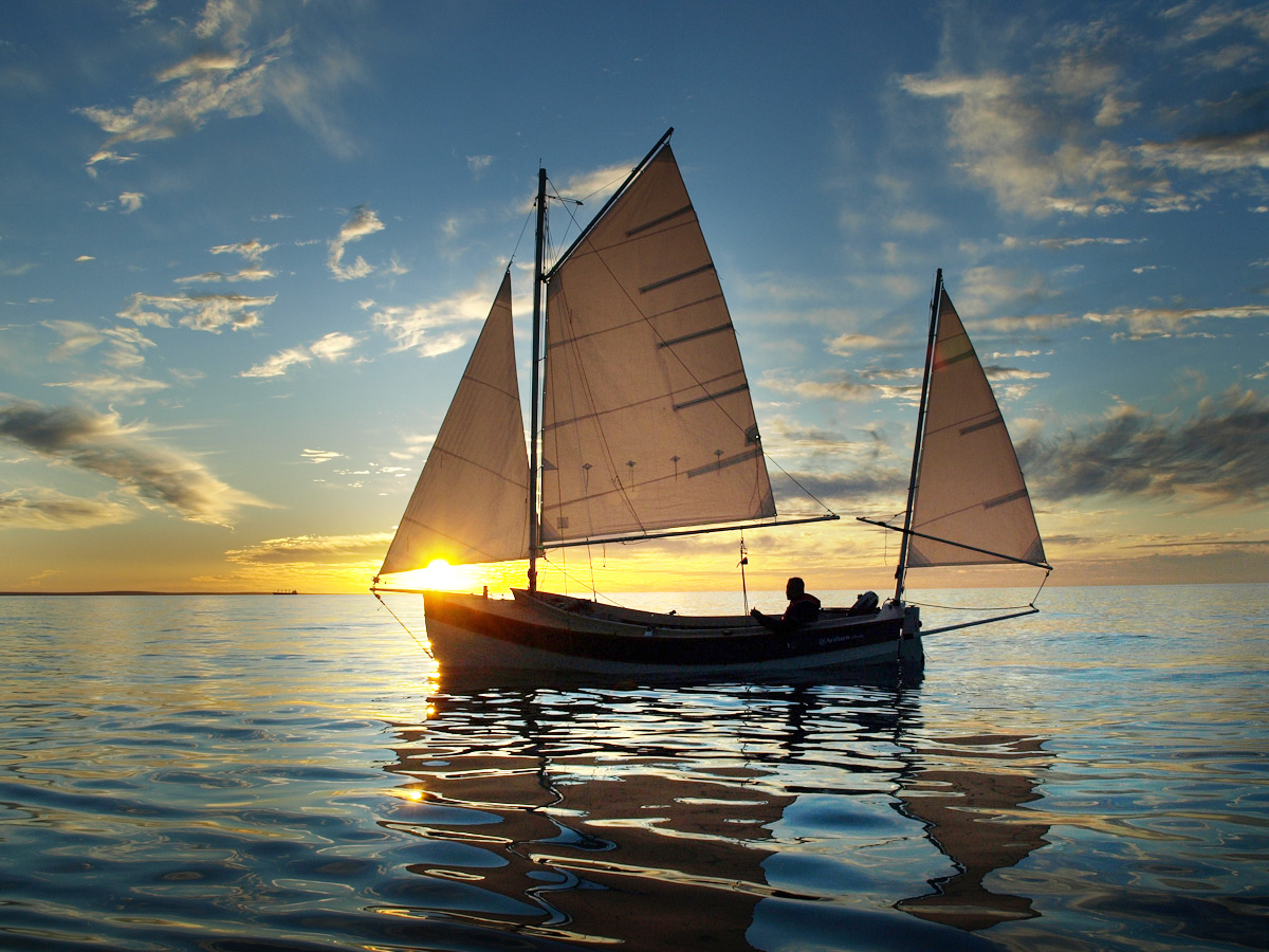
Our optimism of a quick passage was rather misplaced. Fairly quickly we were shaking out our reefs. By lunch time we were perhaps a third of the way there and just limping along in the gentlest of wind. By early afternoon we found ourselves sitting motionless on a very large, slightly undulating mirror. We did our best to amuse ourselves, I improvised a somewhat useless bimini to keep the sun off while Paul managed to catch a ‘Shark Bay Blowie’ a large, ugly and inedible fish that was hurled back. Paul also used the time to experiment with his borrowed oars trying to devise the best way to row a Pathfinder. In the end he was rowing the Pathfinder very efficiently and elegantly by standing up and facing forward, Venetian style. It really did work very well.
Dirk Hartog Island was looking to be beyond our reach. We decided on a plan: Find some land and then camp on it! The gentlest of breeze was coming in again so we altered course to the south towards the prongs. These are two long thin peninsulas that extend well into Denham Sound from the south. Maybe we could get to one of those before nightfall. We limped along a bit further but then what little wind there was started coming from the south. That wiped out that plan so we returned to our original westerly course. It was a strange feeling as we sat in our little boats watching the sun go down. It was warm, balmy, dead calm, and we were at least 15km from the nearest land. It would appear that we had managed to spend the whole day getting ourselves as far from land as you can get in Denham Sound. This was going to be an interesting experience, I guess we’ll cope…
Now we did have auxialliary outboards and we should probably have fired them up hours earlier but we had held back. I guess we had some romantic notion of wanting to sail, not motor, to our destination but the other reason was that we had rather limited fuel. We had only anticipated ever needing the motors for short periods, perhaps to negotiate a narrow passage against the wind or tide. We certainly had not imagined having to make an extended passage under power.
As darkness fell we got out our torches and head lamps and hung up our navigation lights. There was no traffic anywhere in sight that we had to worry about, the main thing was to make sure we would not lose each other in the dark. We still had phone reception so I sent an explanatory text to Wende saying, “It’s OK we are just becalmed”, in case she was monitoring my Spot tracker and getting worried. The markers for the channel into Useless Loop were now flashing in front of us but they were some way off making us realize how far we still had to go. The warm balmy silence that we had been enjoying had to come to an end, we fired up our outboards and with me in the lead, GPS in hand, we headed off.
I was a bit worried about the heading arrow on my GPS, it seemed to be pointing in the wrong direction. At the same time Paul kept complaining that I was heading way off to the south. Eventually it dawned on me that I had fixed my position on the chart relative to another set of markers on a different section of the channel into Useless Loop. I had got myself hopelessly confused. With the chart now illuminated by my red face we carried on. After what seemed like ages we finally passed the channel markers. It was a bit disconcerting to leave these friendly lights behind because in front of us there was nothing. No lights, no moon, nothing, just a black vacuum. Into this vacant nothingness we carried on, and on, and on. We really had got ourselves a long way from land. We paused to refill the tanks on our outboards. We were relieved to see that they were using very little fuel, our boats were gliding over the glassy black water with little resistance. Now, one is told that a GPS is typically accurate to 5m, certainly 10m, but it was with some trepidation that I finally started to steer in a long gentle arc that supposedly took us through this black emptiness into Tetradon Loop.
We had our charts but charts are designed for people with big boats who don’t want to bump into the land, and just want places deep enough to anchor. Our needs were different, we wanted to bump into the land, but before we bumped into it we wanted to know what the beach was like, how steeply it shelved, and where you could put a tent, charts are useless for this. Supposedly we were now inside Tetradon loop, I aimed into the shore. We shone our torches ahead but they made no impression on the total blackness. Shining them down revealed a white sandy bottom, that was a good start. We were disturbing the fish, they were everywhere and creating an incessant chatter of splashes as they jumped out of the water around us. 200 metres to go my GPS said, still nothing. Then, a little to my astonishment but as predicted, the shore dimly appeared, the first bit of land we had seen for many hours. However, it was not a beach, instead we were confronted with a low sandstone cliff. I consulted the topographic map on my GPS, the contours looked lower a few hundred metres further down. Off into the darkness we went only to be greeted, of course, by a lower section of the same sandstone cliff. Hmm, lets try the western side, it was about one and a half kilometres away. This time we ran aground about 500m from the predicted shore line. We realized that our maritime version of blind man’s buff was pointless. We backtracked into deeper water, dropped our anchors, pulled our tarps over our booms, and laid our sleeping bags out on our dew saturated decks. It was almost midnight and overwhelmingly still, yes, this was the sound of silence.
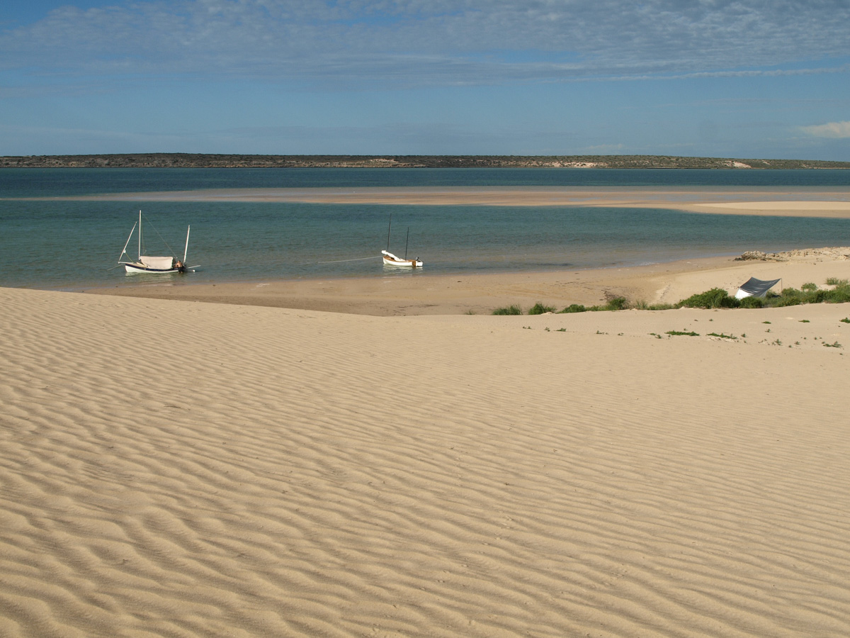
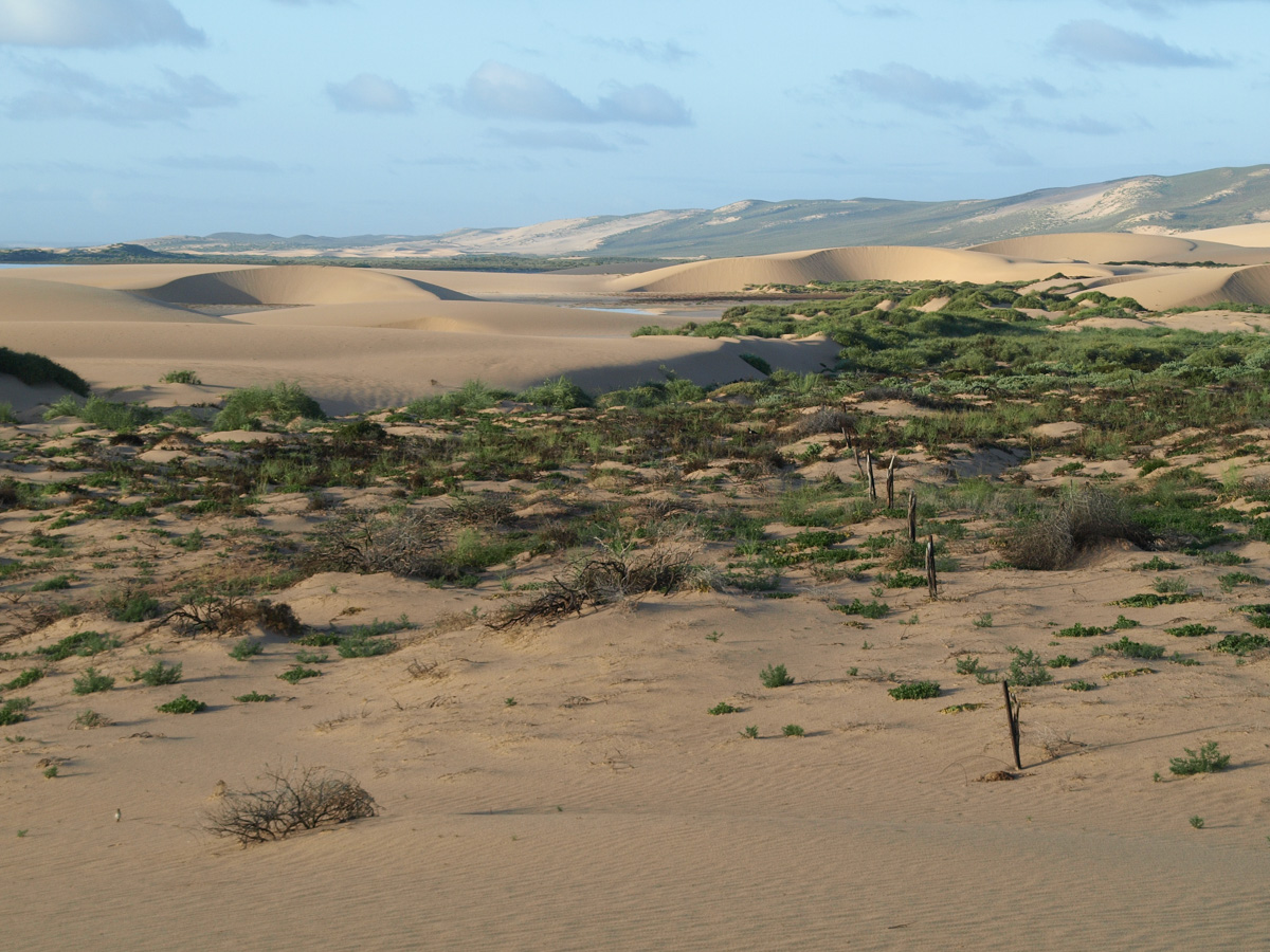
At dawn we emerged blearily from our sleeping bags and then dropped our jaws in wonderment at the scene that greeted us. To our west was a vast field of dunes that rose and merged gradually with a massive sand ridge in the distance that presumably formed the backbone of the island. We sat there in the silence taking it all in and slowly organising breakfast on board while we let the sun rise. We paddled our boats to the beach and waded ashore with cameras in hand and attempted to somehow capture a sense of the extraordinary landscape. I had spent the last 24 hours on my boat, Paul had been 36 hours on his having slept aboard when we were at the Big Lagoon. Our mission for the day was to pick out a spot to sit out the storm that was due that night and early Wednesday morning. Climbing to the top of a dune to survey our options we decided on a small cove to the north of us that offered plenty of protection and a camping spot that had a bit of vegetation about it.
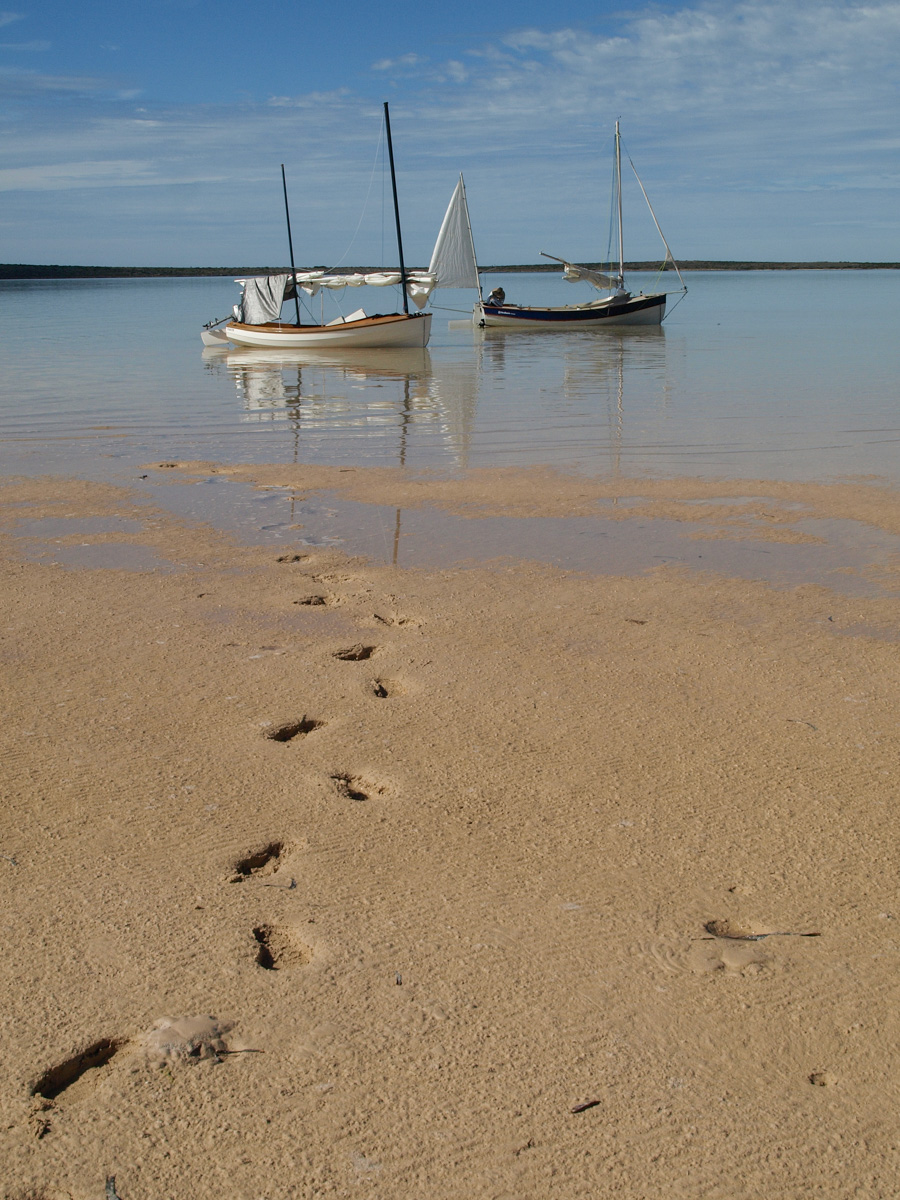
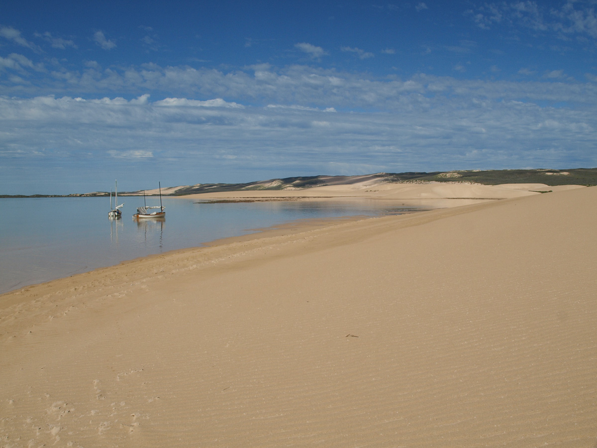
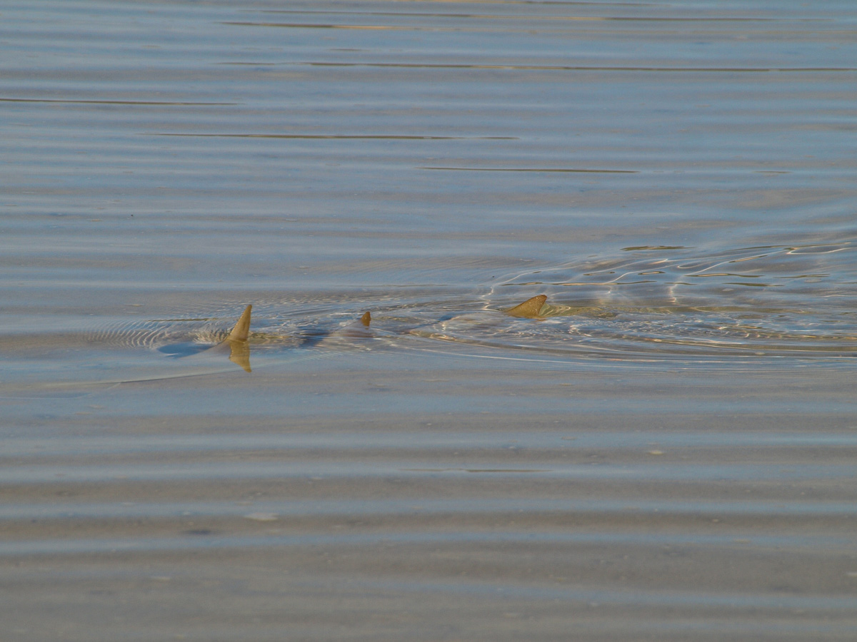
As we paddled and rowed our boats to our chosen spot juvenile sharks and rays would slip away as they detected the pressure waves of our hulls. We were pleased with our little cove. The dune behind it gave us protection from the wind and also acted as our telecommunications centre. We were beyond the limits of reception for our hand held radios but if you climbed to the top you could get one bar of phone reception. We set to work setting up camp and securing our boats. As the day wore on the wind strengthened from the northeast and then gradually turned towards the northwest.