Table of Contents
Mandurah and Peel-Harvey Inlet
DoT Mandurah boating guide
Chart WA848 Peel Inlet and Harvey Estuary
Mandurah forecast
Windy.com forecast
Local waters forecast Two Rocks to Dawesville
Local waters forecast Dawesville to Cape Naturaliste
Mandurah Marine Rescue
Callsign: VMR 611
Log on using VHF channels 77 or 82 or by mobile phone - 9535 4789
The Peel Inlet is about 75 km^2 and the Harvey Estuary is about 60 km^2 giving you a vast area to sail and explore. In addition to this there are the Murray and Serpentine Rivers and, if you are in a kayak or row boat, the Harvey River to explore.
There are a large number of ramps in the Mandurah region. These have been organised as follows:
Mandurah Ramps
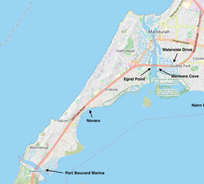
Egret Point
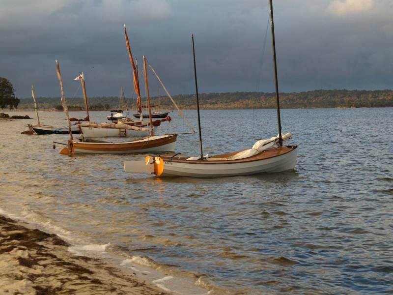
Not a ramp but a handy beach launching spot used by FOAM (Federation Of Ancient Mariners). They sail from here most Thursday mornings unless the weather is bad. Turn up with your boat, a thermos and something for morning tea and you will have a great time.
You can back your car right up to the beach and get your boat straight off onto the sand, very handy. With luck the coffee van will be there. Toilets are at the back of the car park.
When leaving or returning to the beach use the northern end towards the bridge as there is foul ground directly off the beach.
Typical expeditions out from here can be:
- A short trip down the channel into town for a coffee. The Estuary Bridge clearance is 6.6m but note the Mandurah Bridge is only 4.4m.
- A short trip up the channel to Boundary Island which has a nice beach to pull up on and have morning tea.
- Out into the Peel Inlet and around the science platform
- Across the inlet and into the lower section of the Murray. The south bank on Meeyip Island has a useable beach.
- If the conditions are good some of the hardy FOAMies do a 'Matthew Flinders', a circumnavigation of Halls Head. Down to Dawesville, out through the cut, and then north around Halls Head returning through the main channel. Needs favourable tidal flow and a boat that can get under the Mandurah Bridge (4.4m)
Mariners Cove
This ramp is across the channel from Egret Point making it a handy launch point if want to join the FOAM group for a sail but your boat needs a ramp. Best if you have a motor or oars as it is not really a ramp to sail in and out from.
Waterside Drive
Novara
Situated at the north western corner of Peel Inlet. Toilets and picnic area are adjacent. The Novara general store is not far away on the Old Coast Road. Note that there is a large area of shallows surrounding the channel in and out of the ramp.
Harvey Estuary
Port Bouvard Marina
This is a privately operated marina situated on the northern side of the Dawesville Cut. The main reason you might use this ramp is if you want a moderately secure place to leave your car and trailer for a multi-day trip out in the estuary. There is a modest day charge for using the ramp ($10 the last time I used it). The facilities are excellent including a wash down area for after you have retrieved your boat. There is also a nice restaurant and cafe. Not a ramp to sail in an out of, you must motor or row.
Marina web page
Google Maps Location
Port Bouvard Yacht Club
This is a basic ramp for servicing the yacht club. Only accessible if you have made a prior arrangement to use the ramp with the club (as is the case with some OGA events)
Dawesville
This is the main ramp to use if you want to sail the Harvey Estuary. Plenty of jetty length for holding boats when launching or retrieving. At the southern end of the car park there is a small beach launching spot for kayaks or boats on trolleys. Good cafe over the road and toilets in the park.
Park Ridge
Island Point Reserve
A beach launch spot at the southern end of the Estuary. Only suitable for small craft as the shallows are extensive. A very attractive spot for paddling or rowing across to Heron Point via the island at the southern end. It is also a good spot to launch from for exploring up the Harvey River. There is a very nice shady picnic area with toilets.
Heron Point
A basic ramp servicing the camping area at Heron Point. This is a great location to sail down to from Dawesville for an overnight camp. A nice beach extends northwards from the ramp.
Murray River
Rivergums
North Yunderup
While it is a bit constrained for space this is a handy ramp for joining in with the North Yunderup Yacht Club's sailing activities. They run friendly races on every 4th Saturday of the month and on most public holidays.
Note that you just have a small jetty to hold your boat while you park your car and trailer, there is no beach. Toilets are in the car park.
Murray Bend
Pinjarra
A quiet ramp just downstream from Pinjarra. A nice place to launch from for an explore down the Murray. In the right conditions a fair bit of (challenging) sailing is possible. However, in general, expect to be motoring or rowing. Do note that between here and Ravenswood a number of powerlines cross the river. Some are very high but some are not quite as high as one would like and can be hard to see in good time because the trees obscure them.
Serpentine River
Nairn Road
A quiet little ramp giving you access to the lower end of the Serpentine. No facilities, stop off at the Coodenup Foreshore Playground for toilets on your drive into the ramp.
While the narrow river can be challenging in places this is quite a fun place to sail from. Explore as far as you can up the Serpentine or head downstream where you can go out into the inlet or head up into the Murray.
Furnissdale
Have not used this ramp but it looks like a better option than Nairn Road for access to the Serpentine.


